SCENIC DRIVES

Explore Rifle and beyond

Whether you want to explore the areas immediately surrounding Rifle, or take a day-trip to check out the Flat Tops, Grand Mesa, or Ruedi Reservoir, Rifle is located in the center of the bulls-eye for those looking for scenic drives on Colorado’s Western Slope.

Rifle Creek Valley

RIFLE CREEK VALLEY

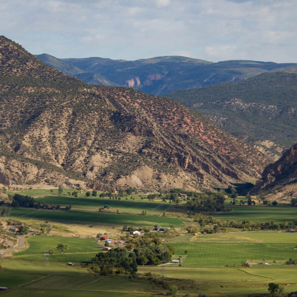
About 5-minutes north of Downtown Rifle off Highway 13 is County Road 325, which threads its way through Rifle Creek Valley. This road begins at Rifle’s Fireside Lanes bowling alley at the corner of Highway 13 & CR 325, and travels northeast about 15 miles ending at the Three Forks Trailhead. The first part of the drive will take you past beautiful ranches and the Rifle Creek Golf Course and features scenic views of Rifle Gap and the Grand Hogbacks. Once you pass Rifle Creek Golf Course, you’ll drive through Rifle Gap, a notch passing through the steep ridges of the Grand Hogback.  The environmental artist Christo famously hung a curtain across this gap in 1972.  The road continues north along a tailwater section of Rifle Creek that’s known by local anglers as an outstanding fly fishing area with its great pocket water. The road gains elevation, bringing you to the top of Rifle Gap Dam, where you can view Rifle Gap and Mamm Peaks to the south and Rifle Gap Reservoir and Cedar Mountain to the north. From the reservoir, you’ll drive across Rifle Gap Dam heading northeast. Over the course of the next few miles you will wind past the Harvey Gap cutoff road (CR 237), Rifle Falls State Park, Rifle Creek Riparian Zone, and the Rifle Fish Hatchery until you reach the entrance to Rifle Mountain Park. CR 325 drives directly through Rifle Mountain Park for about 2-miles and is beautifully scenic all four seasons of the year. Its massive canyon walls will feature rock & ice climbers depending upon the time of year. Rifle Mountain Park is consistently ranked as one the top limestone climbing destinations in the country drawing amateur and professional climbers from all over the world. From the north end of Rifle Mountain Park, it’s another 3 miles until Three Forks Trailhead, which connects people to hiking, mountain biking, snowshoeing opportunities and a series of forest roads that travel throughout the portion of White River National Forest known as the Flat Tops. The entire drive can take anywhere from 40 minutes to 2-hours, depending on how often you stop and enjoy the views, activities, and wildlife.

County-Road-252-West-Rifle-Creek-SWA-2-1920x876

WEST RIFLE CREEK VALLEY FEATURES YEAR-ROUND WILDLIFE VIEWING

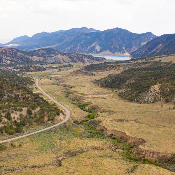
About 15-minutes from Downtown Rifle is County Road 252 which can be accessed on the west end of Rifle Gap Reservoir. The road is a well-maintained gravel road that travels north through West Rifle Creek Valley to Meeker.  Piceance Creek Road (CR 253) connects travellers to Highway 13 about 12 miles north of Rifle.

The terrain along the road is a classic western landscape of sagebrush, pinyon, and juniper trees with agricultural land spread throughout. The mountains of the Grand Hogback and the Flat Tops rise to aspens and fir on both sides of the valley. This drive is known to locals as a great place to view wildlife, especially from May through October.   Deer and elk are commonly seen here, especially around dawn and dusk. In addition to deer and elk, there are also moose, bear, coyotes, mountain lion, eagles, turkeys and many types of birds and small mammals.

hunting-flat-tops-elk-799x533

FLAT TOPS // BUFORD ROAD

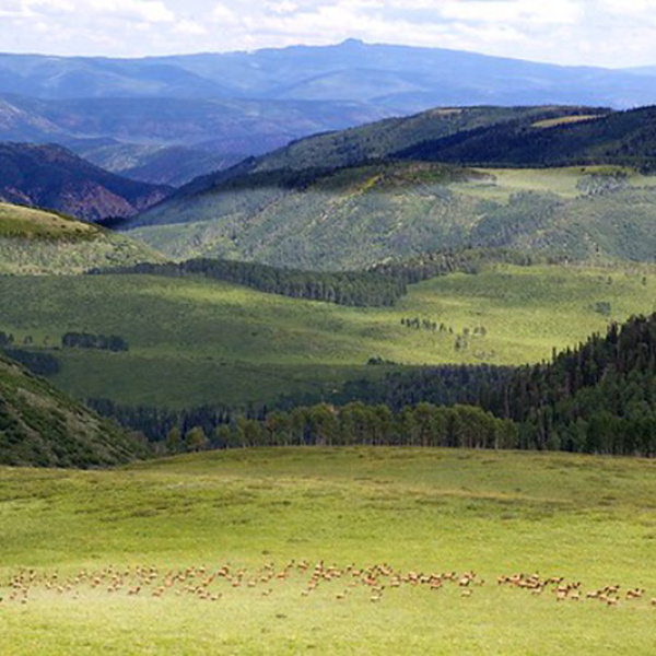
Buford Road spans 42-miles throughout the Flat Tops section of the White River National Forest.  It is a seasonal road that stretches from Buford to Rifle and is one of the most scenic drives in the entire state of Colorado. It takes about 25-minutes to access the south section of Buford Road from Downtown Rifle, and another few hours to drive over the Flat Tops into the community of Buford, just east of Meeker. The Buford Road connects with the official “Flat Tops Scenic Byway” in the town of Buford and continues east to the town of Yampa. From Buford, it takes about an hour to drive back to Rifle via Highway 13. The Flat Tops make you feel like you’re driving through a scenic postcard with mountains, valleys, lakes, and wildlife. Buford Road is closed throughout the winter months but it’s an ideal scenic drive throughout the summer and fall.

Grand-Mesa

GRAND MESA SCENIC BYWAY

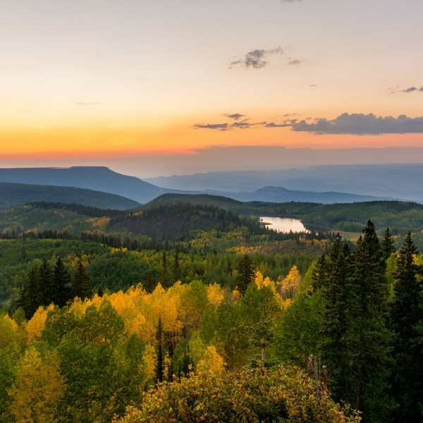
Even with the designation of being the largest ‘Flat Top Mountain in the World’, the Grand Mesa is still relatively unknown to many visitors to the area. It has an area of about 500 square miles and stretches for about 40 miles east of Grand Junction between the Colorado River and the Gunnison River, its tributary to the south. The scenic byway starts in Mesa, and travels through the Grand Mesa, Gunnison, and Uncompahgre National Forests and ends in Cedaredge. The 63-mile road travels through a massive canyon to the top of the mesa which plateaus at approximately 11,000′ above sea level. The drive takes about 90-minutes along Highway 65 with an additional 30 minutes for those who travel Land’s End Observatory. This drive is hands down one of the most picturesque scenic drives on the western slope, especially in the fall months when the leaves are turning.
Roaring_Fork

Frying Pan Road

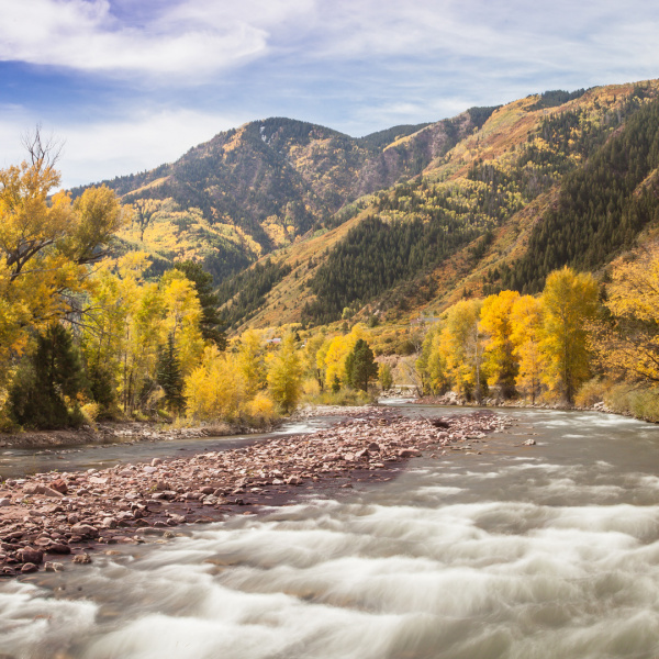
Another picturesque drive that’s within close proximity to Rifle is County Road 104 that begins in the town of Basalt, approximately 45 minutes from Rifle. The road travels 16-miles along the Fryingpan River to Ruedi Reservoir. Once at Ruedi, the road continues east into the mountains and ends at Wildcat Mountain, only a few miles west of Leadville (as the crow flies!) The colors along the Fryingpan River and throughout Ruedi and the surrounding mountains are some of the most vibrant you’ll see, especially in the fall months when the leaves turn yellow, red and orange. Make sure to bring your fly fishing gear because the Frying Pan River is known as one of the best fly fishing streams in Colorado.