Rifle Rest Area

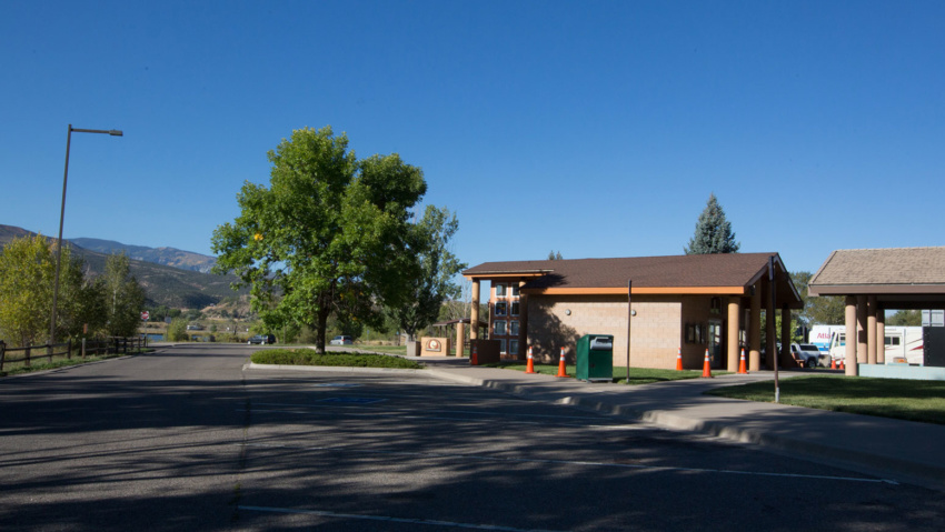
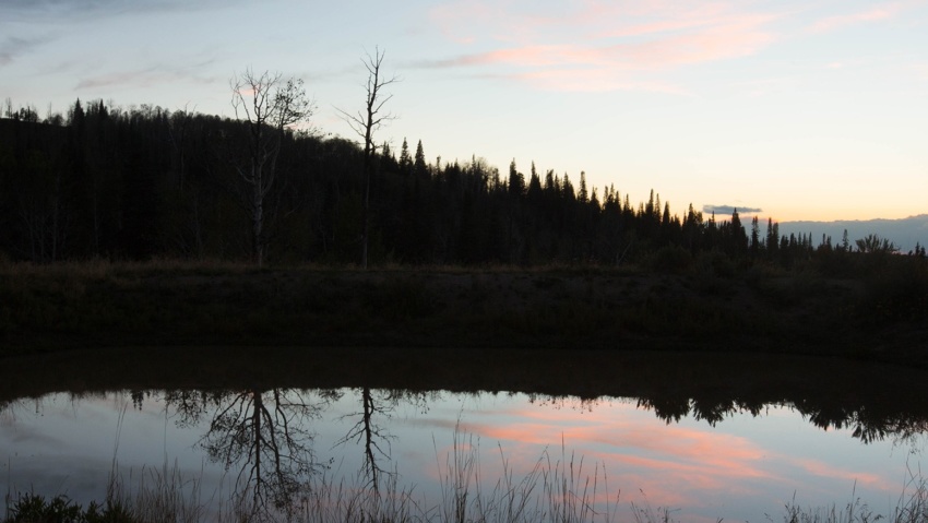
Rifle Rest Area The Rifle Rest Area is located off of Exit 90 from I-70. The Rifle Rest Area is located off of Exit 90 from I-70. The rest area sits next to scenic Lions Pond and visitors are welcome to picnic, walk the trail around the pond, or enjoy an afternoon of fishing. The rest area includes restrooms, a…

Read more

Rifle War Memorial

Rifle War Memorial The Rifle War Memorial pays tribute to the local men and women who have served their country in our nation’s wars. Head north on highway 13 and turn left on 30th St. where you’ll find the memorial on the north side of the road.

Read more

Rulison Detonation Site

Rulison Detonation Site The Rulison Detonation site is located on the Battlement Mesa 12 miles southwest of Rifle and 8 miles southeast of Parachute on County Road 302. On September 10, 1969 the federal government detonated a subterranean nuclear bomb more than 8,000 feet below ground in an attempt to break loose natural gas deposits found in the tight sandstone…

Read more

Cow Creek Road

Cow Creek road Cow Creek Road offers an easier, albeit Longer alternate ROute to the JQS Trail for accessing the top of the Roan Plateau. This Cow Creek Road can be accessed by taking Highway 13 North out of Rifle for 18 miles, then taking the Piceance Creek Road (County Road 5) West toward Rangely for 4.5 miles.  The Cow Creek…

Read more

JQS Road

JQS Road 4×4 Recommended The JQS Road is a 7-mile dirt road adventure climbing 3,000 feet up the side of the Bookcliffs to the top of the Roan Plateau. The route is great for OHVs, mountain bikes, and vehicles with 4-wheel drive and high clearance who are willing to brave the extremely narrow, steep, rocky, and potentially treacherous conditions. Near…

Read more

Mamm Peak

Mamm’s Peak The Mamm Peaks tower majestically 6,000 feet over the Colorado River Valley. They Are the remnants of an ancient volcanic rim There are several rugged peaks along the ridge, including Sugarloaf Mountain, Haystack, Mountain, and North Mamm Peak which tops out an elevation of 11,123 feet.  Each peak is a jumble of volcanic boulders and ancient lava flows…

Read more

The Flat Tops

THE Flat Tops The region is a high plateau filled with forests, meadows, hills, canyons, valleys, and spectacular views of DISTANT mountain ranges. The name Flat Tops refers to a large region of the White River National Forest northeast of Rifle.  Contrary to their name, the western Flat Tops nearest Rifle are not actually flat. More accessible than its wilderness…

Read more

Rifle Creek Valley

Rifle Creek Valley Follow Rifle Creek as it spills out of the Flat Tops and into the ranchlands and communities below. This trip highlights the best of Rifle. And bring your toys! With three State Parks (Rifle Falls, Rifle Gap, and Harvey Gap) Rifle Mountain Park, Rifle Creek Golf Course, and endless BLM and Forest Service lands, you can spend…

Read more

Rifle Area

Rifle Area There is much more to the City of Rifle (population 9,300) than meets the eye from Interstate 70. Head to the north side of the Colorado River and the historic neighborhoods of Rifle. Here you will find a variety of shops, restaurants, parks, neighborhoods, and amenities in restored historic buildings. You’ll find the Classic West of gun shops,…

Read more

Roan Plateau Area

Roan Plateau Area The Roan Plateau rises 4,000 feet above the Colorado River Valley. From Rifle, the view of the Roan Plateau is the imposing Bookcliffs and Anvil Points. A drive or bike ride up to the top of the plateau offers so much more. The top of the Roan a wonderland of stunning views, deep canyons, waterfalls, aspen forests,…

Read more