Meadow Lake

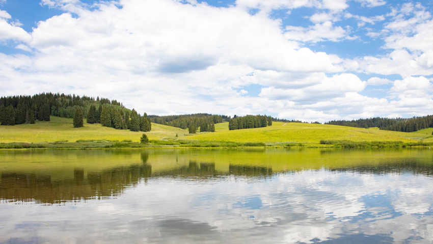
Meadow Lake A Beautiful Destination in the Flat Tops Meadow Lake is about a 1 1/2 hour drive from New Castle on the Buford Road (CR 245). The campground is on the northwest side of the lake. Fishing is available with a valid Colorado fishing license. This area is a popular ATV basecamp for trips throughout the Flat Tops. No…

Read more

Fravert Reservoir

Fravert Reservoir Fravert Reservoir provides a beautiful setting for bird watching beneath the majestic Roan Plateau To reach Fravert Reservoir, visitors will take the Rifle By-Pass onto County Road 244 (Fravert Reservoir Road) where they will find a parking area on the left hand side of the road.  Waterfowl abounds on the reservoir much of the year.  Please obey the…

Read more

Battlement Reservoirs

Battlement Reserviors The Battlement Reservoirs are a chain of seven reservoirs located in a magnificent, moutain setting south of Parachute, Colorado. The reservoirs are an ideal location for fishing, hunting, camping, hiking, and solitude. From Rifle head west on I-70 to Parachute, 16 miles, and take exit 75. Turn left on County Road #301. Follow Co. Rd. #301 across the…

Read more

Coulter Lake

Coulter Lake Coulter Lake is a pristine mountain lake three miles into the White River National Forest, north of Rifle. Accompanying the lake is a small guest ranch open year round to guests looking for real western adventure. The ranch offers trail riding, fishing, hiking, mountain biking, snowmobiling and more. View Real Western Adventure Map View Flat Tops Area

Read more

Rifle Arch Area

Rifle Arch AREA The Rifle Arch Trail is an easy to moderate hiking trail leading to a stunning sandstone arch formation. Located north of Rifle off of Highway 13. Hikers should head north on Railroad Ave., which becomes Highway 13, for approximately 6.5 miles. You will find the trailhead and parking on the right side of the road at mile…

Read more

West Mamm Creek Trailhead

West Mamm Creek Trailhead Length: 12 miles out-and-back (shorter hikes on this trail are still worthwhile) Elevation gain: 2,700 feet (7,840 feet to 10,500 feet) The West Mamm Creek Trail is a hiking trail that climbs into the Mamm Peaks region (also called Battlement Mesa) from the east.  Only a 15 minute drive from Rifle, it begins in aspen trees and ends…

Read more

Three Forks Trail

Three Forks Trail The Three Forks Trail is a great hike or mountain bike ride close to Rifle Mountain Park. The trail follows a fork of Rifle Creek into aspen and evergreen forests for several miles. It eventually meets up with other trails and jeep roads that lead further into the Flat Tops. To get to the trailhead from Rifle,…

Read more

North Slopes of Hogback Trail

North Slopes of Hogback Trail Length: 5 miles out-and-back Elevation Gain: 1700 feet (starts at 6,100 feet and ends at 7,800 feet) This hike is perhaps the least known yet most pristine example of the classic Rifle landscape of sagebrush and cactus hills, dry washes, mature pinyons and juniper forests, and the craggy Grand Hogback. A crossing of West Rifle…

Read more

Morrow Draw Trail

Morrow Draw Trail The Morrow Draw Trail is .75 mile gravel trail that winds through the Morrow Draw Open Space. Patches of woods, meadows, and flowing streams are frequented by a variety of wildlife. It’s a natural oasis in the middle of town. Visitors can enjoy views of the magnificent Roan Plateau from the two sitting areas along the trail.…

Read more

The Mamm Peaks

The Mamm Peaks The Mamm Peaks are located approximately 8 miles south of Rifle in the White River National Forest. They can be accessed from a number of different points. From the west, visitors can access the Mamm Peak roadless area and the Battlement Reservoirs via Interstate 70 at Parachute. Cross the Colorado River on Garfield County Road (CR) 300…

Read more