Search
Close this search box.

Lions Pond and Trails

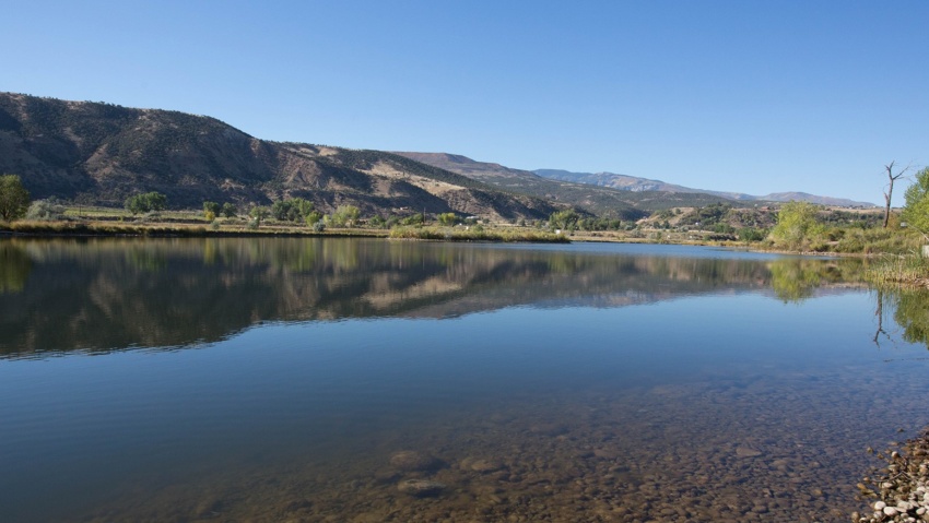
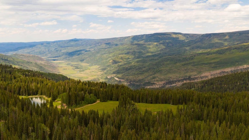
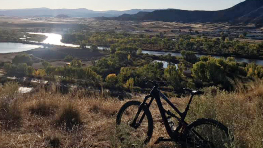
Lions Pond and Trails Lions Pond sits beneath the majestic Roan Plateau and adjacent to the Colorado River. Lions Pond is located right off of I-70 at Exit 90 in Rifle. Originally, the pond was a gravel pit that was created in the early 70’s when the interstate was being built. Visitors are encouraged to spend the day fishing for…

Read more

Hadley Gulch Trail

Hadley Gulch Trail The Hadley Gulch trail is a nice hiking trail leading into the Flat Tops area. It is 5.0 miles long. It begins at Forest Road 603 and ends at Forest Road 653. The trail is open for the following uses: Hiking and Horseback Riding. From Rifle, go east to New Castle (15 miles) exit 105. Turn left…

Read more

Estes Gulch Trail

Estes Gulch Trail Length: 1.25 miles out-and-back Elevation Gain: minimal The Estes Gulch Trail is a short hike into a Hogback canyon with cool rock formations and fantastic mining ruins. We won’t post pictures here to leave the surprise for your trip. Biking or hiking the dirt road from the highway turnoff can make this a longer excursion if so…

Read more

Coyote and Squirrel Trails

Coyote and Squirrel TRAILS In Rifle Falls State Park, the Coyote Trail winds past limestone caves, through a lush riparian and forested area, then climbs to a birds-eye view of Rifle Falls. Kids of all ages will love exploring the caves. Bring a flashlight for the largest one. Squirrel Trail crosses East Rifle Creek and winds through Gambel oak forest…

Read more

Cliff Lakes Trail

Cliff Lakes Trail This trail provides access to THE Cliff Lakes and South Fork Campground Cliff Lakes Trailhead is located off Forest Road 601. Four-wheel drive vehicles are highly recommended. From Rifle, head east on I-70 for 15 miles. At the New Castle exit (105), turn left at the ramp and follow the signs into New Castle. At 7th Street…

Read more

Bobcat Trail

Bobcat TrAIL The trail hikes along East Rifle Creek through boxelder and cottonwood forests, and into open grassy meadows. This is a newly completed trail that links Rifle Falls State Park and Rifle Falls State Fish Hatchery. It provides access to secluded fishing spots on the creek bank, as well as passing several well stocked trout ponds managed by the fish…

Read more

Beaver Creek Trail

Beaver Creek Trail Beaver Creek Trailhead #2161 is one of the closest Forest Service recreation sites to Rifle, located just 9.5 miles from the roundabout just south of I-70.  It’s a great hike all four season of the year, however, you’ll need snowshoes in the winter months. The trailhead is located 9.4 miles from the roundabout just south of the I-70 overpass.…

Read more

Battlement Trail (Parachute Trailhead)

BATTLEMENT TRAIL(PARACHUTE TRAILHEAD) Battlement trailhead provides access to a 4-wheel drive jeep trail and a hiking/horseback trail to the Battlement Reservoirs. The Battlement Reservoirs are a chain of seven lakes located in a pristine high mountain setting, south of Parachute Colorado. From Rifle, head west on I-70 to Parachute (15 miles) and take exit 75. Turn left and follow County…

Read more

West Elk Trailhead & Parking Area

Buford Road Parking Area and Trailhead the West Elk Trailhead, is a popular jumping off point for summer and winter outdoor activities in the Flat Tops From the parking area you can access miles of multi-use trails and roads, including the Cherry Creek Trail and Mansfield Ditch for mountain biking and hiking and a maintained cross-country ski area in the…

Read more

Highland Trail for Biking & Hiking

HIGHLAND TRAIL The Highlands Trails offers approximately 3 miles of trails for both hikers, trail runners, and mountain bikers. Highland Trails are located within city limits just south of Highland Elementary with access points on 7th and Fir Ave, as well as at the end of 5th street. These trails are perfect for beginner mountain bikers to hone their skills before…

Read more