Search
Close this search box.

OHV

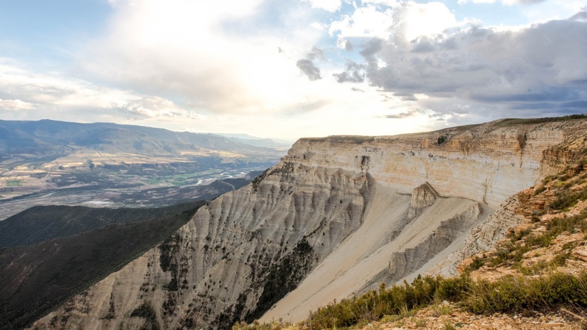
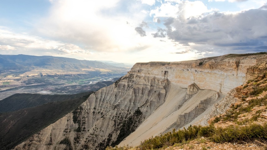
OHV Rifle’s location at the center of the western slope means immediate access to some of Colorado’s most awesome OHV & ATV trails Hubbard Mesa Recreation Area is one of the Rifle region’s most popular recreational areas and is located just outside the city limits. Additional local OHV trails arefound on the Roan Plateau, Battlement Reservoirs, Flat Tops, and the…

Read more

Cow Creek Road

Cow Creek road Cow Creek Road offers an easier, albeit Longer alternate ROute to the JQS Trail for accessing the top of the Roan Plateau. This Cow Creek Road can be accessed by taking Highway 13 North out of Rifle for 18 miles, then taking the Piceance Creek Road (County Road 5) West toward Rangely for 4.5 miles.  The Cow Creek…

Read more

JQS Road

JQS Road 4×4 Recommended The JQS Road is a 7-mile dirt road adventure climbing 3,000 feet up the side of the Bookcliffs to the top of the Roan Plateau. The route is great for OHVs, mountain bikes, and vehicles with 4-wheel drive and high clearance who are willing to brave the extremely narrow, steep, rocky, and potentially treacherous conditions. Near…

Read more

The Flat Tops

THE Flat Tops The region is a high plateau filled with forests, meadows, hills, canyons, valleys, and spectacular views of DISTANT mountain ranges. The name Flat Tops refers to a large region of the White River National Forest northeast of Rifle.  Contrary to their name, the western Flat Tops nearest Rifle are not actually flat. More accessible than its wilderness…

Read more

Rifle Creek Valley

Rifle Creek Valley Follow Rifle Creek as it spills out of the Flat Tops and into the ranchlands and communities below. This trip highlights the best of Rifle. And bring your toys! With three State Parks (Rifle Falls, Rifle Gap, and Harvey Gap) Rifle Mountain Park, Rifle Creek Golf Course, and endless BLM and Forest Service lands, you can spend…

Read more

Roan Plateau Area

Roan Plateau Area The Roan Plateau rises 4,000 feet above the Colorado River Valley. From Rifle, the view of the Roan Plateau is the imposing Bookcliffs and Anvil Points. A drive or bike ride up to the top of the plateau offers so much more. The top of the Roan a wonderland of stunning views, deep canyons, waterfalls, aspen forests,…

Read more

Hubbard Mesa Recreation Area

Hubbard Mesa Hubbard Mesa is a 2,480-acre colorful desert landscape of mesas and rock hoodoos at the base of the Roan Plateau. Visitors are greeted with 50 miles of single track, ATV, and jeep trails. This means that when it comes to recreation, if you can dream it you can (mostly) do it. Just be safe out there adventurers! Hubbard…

Read more

Meadow Lake

Meadow Lake A Beautiful Destination in the Flat Tops Meadow Lake is about a 1 1/2 hour drive from New Castle on the Buford Road (CR 245). The campground is on the northwest side of the lake. Fishing is available with a valid Colorado fishing license. This area is a popular ATV basecamp for trips throughout the Flat Tops. No…

Read more

Battlement Reservoirs

Battlement Reserviors The Battlement Reservoirs are a chain of seven reservoirs located in a magnificent, moutain setting south of Parachute, Colorado. The reservoirs are an ideal location for fishing, hunting, camping, hiking, and solitude. From Rifle head west on I-70 to Parachute, 16 miles, and take exit 75. Turn left on County Road #301. Follow Co. Rd. #301 across the…

Read more

Cedar Mountain Area

Cedar Mountain Area Cedar Mountain rises north out of Rifle Gap The area begins at lake level as high desert pinyon-juniper forest. At its top, it features aspen and evergreen forests at 8,200 feet. ATV and 4WD trails criss-cross the area and it is heavily used for hunting in the fall. From the adventurer’s perspective, it is an interesting area…

Read more