Search
Close this search box.

Grand Hogback Trail at Rifle Arch

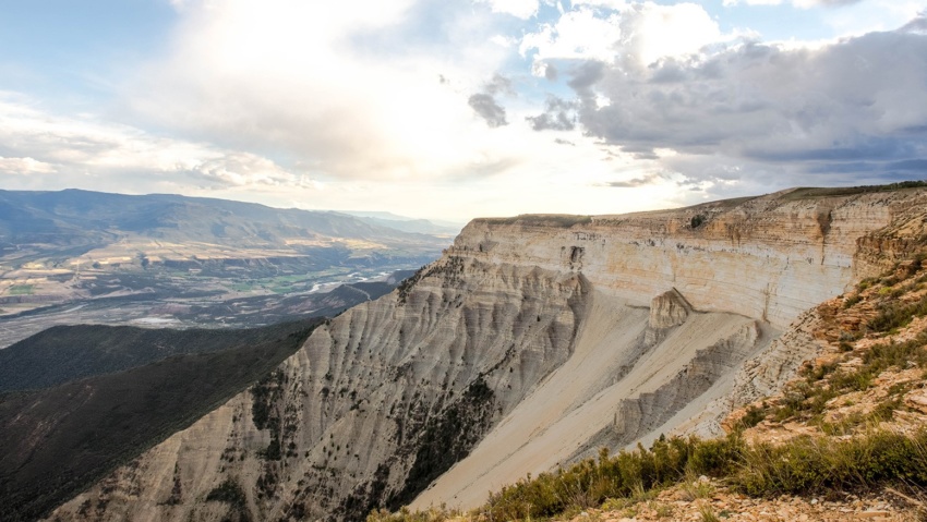
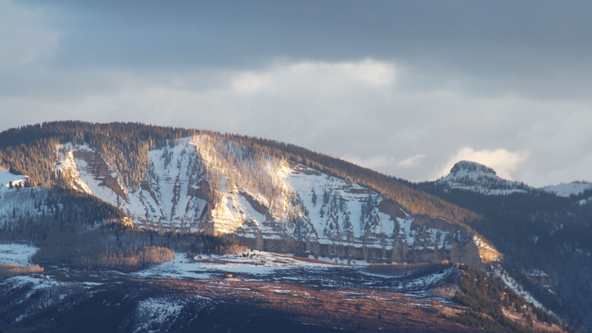
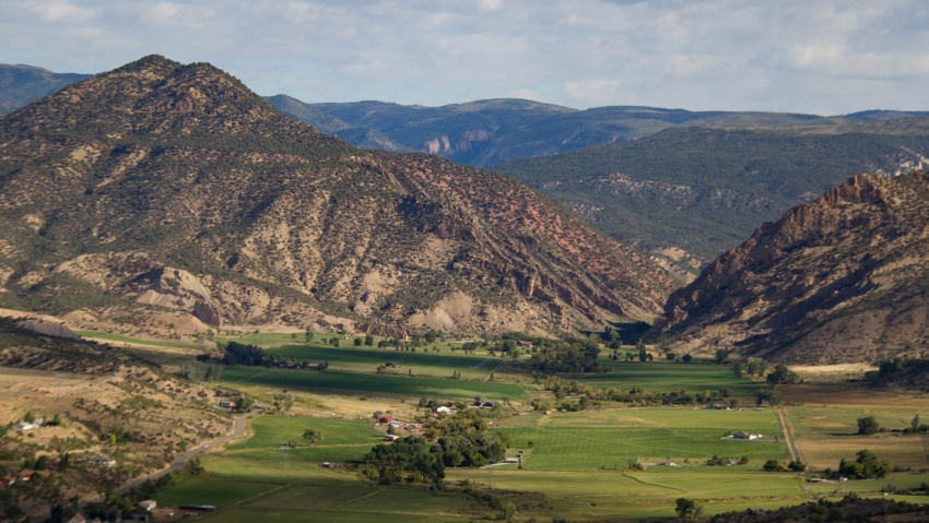
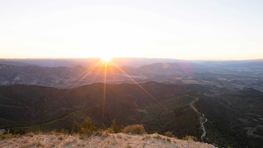
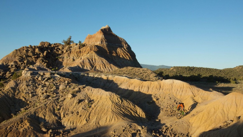
Grand Hogback Trail at Rifle Arch The Grand Hogback Trail at Rifle Arch is located approximately six miles north of Downtown Rifle off Highway 13. When fully complete, the trail system will be over 18-miles long and ideal for beginner, intermediate, and advanced riders. The trail styles feature a mix of singletrack, machine built flow trails, technical rocky trails, and…

Read more

Rifle Gap Dam

Rifle GAP DAM Rifle Gap Dam is about 5 1/2 miles north of Rifle, at a point where Rifle Creek cuts through the Grand Hogback. The dam was built between 1964 and 1967 by the United States Bureau of Reclamation for irrigation water storage. The dam is operated by the Silt Water Conservancy District and creates Rifle Gap Reservoir. The…

Read more

JQS Road

JQS Road 4×4 Recommended The JQS Road is a 7-mile dirt road adventure climbing 3,000 feet up the side of the Bookcliffs to the top of the Roan Plateau. The route is great for OHVs, mountain bikes, and vehicles with 4-wheel drive and high clearance who are willing to brave the extremely narrow, steep, rocky, and potentially treacherous conditions. Near…

Read more

Mamm Peak

Mamm’s Peak The Mamm Peaks tower majestically 6,000 feet over the Colorado River Valley. They Are the remnants of an ancient volcanic rim There are several rugged peaks along the ridge, including Sugarloaf Mountain, Haystack, Mountain, and North Mamm Peak which tops out an elevation of 11,123 feet.  Each peak is a jumble of volcanic boulders and ancient lava flows…

Read more

The Flat Tops

THE Flat Tops The region is a high plateau filled with forests, meadows, hills, canyons, valleys, and spectacular views of DISTANT mountain ranges. The name Flat Tops refers to a large region of the White River National Forest northeast of Rifle.  Contrary to their name, the western Flat Tops nearest Rifle are not actually flat. More accessible than its wilderness…

Read more

Rifle Creek Valley

Rifle Creek Valley Follow Rifle Creek as it spills out of the Flat Tops and into the ranchlands and communities below. This trip highlights the best of Rifle. And bring your toys! With three State Parks (Rifle Falls, Rifle Gap, and Harvey Gap) Rifle Mountain Park, Rifle Creek Golf Course, and endless BLM and Forest Service lands, you can spend…

Read more

Roan Plateau Area

Roan Plateau Area The Roan Plateau rises 4,000 feet above the Colorado River Valley. From Rifle, the view of the Roan Plateau is the imposing Bookcliffs and Anvil Points. A drive or bike ride up to the top of the plateau offers so much more. The top of the Roan a wonderland of stunning views, deep canyons, waterfalls, aspen forests,…

Read more

Hubbard Mesa Recreation Area

Hubbard Mesa Hubbard Mesa is a 2,480-acre colorful desert landscape of mesas and rock hoodoos at the base of the Roan Plateau. Visitors are greeted with 50 miles of single track, ATV, and jeep trails. This means that when it comes to recreation, if you can dream it you can (mostly) do it. Just be safe out there adventurers! Hubbard…

Read more

Harvey Gap Reservoir State Park

Harvey Gap State Park Swimming and Picnic Area A GREAT WAY TO BEAT THE SUMMER HEAT Harvey Gap is a 198 acre reservoir featuring great opportunities for fishing, swimming, and stand-up-paddleboarding.  Motorized boats are allowed with a 20 HP maximum and there is a boat ramp on the east side of the lake. Anglers catch catfish, largemouth and smallmouth bass,…

Read more

Meadow Lake

Meadow Lake A Beautiful Destination in the Flat Tops Meadow Lake is about a 1 1/2 hour drive from New Castle on the Buford Road (CR 245). The campground is on the northwest side of the lake. Fishing is available with a valid Colorado fishing license. This area is a popular ATV basecamp for trips throughout the Flat Tops. No…

Read more